As most of the United States slowly comes out of the Covid Quarantine, many of us are itching to get outside. But how can you leave your house, see some incredible nature and get some exercise WHILE staying healthy and maintaining social distance? If you answered hiking, well, good work Captain Obvious.
Once the National Parks began to partially re-open, I figured now would be a great time to take a road trip and disappear into some of my favorite National Parks to take photos and hike. So of course, I headed straight from my home in Boise, Idaho to one of my favorite parks to photograph, Bryce National Park, part of the Mighty Five in Southern Utah.
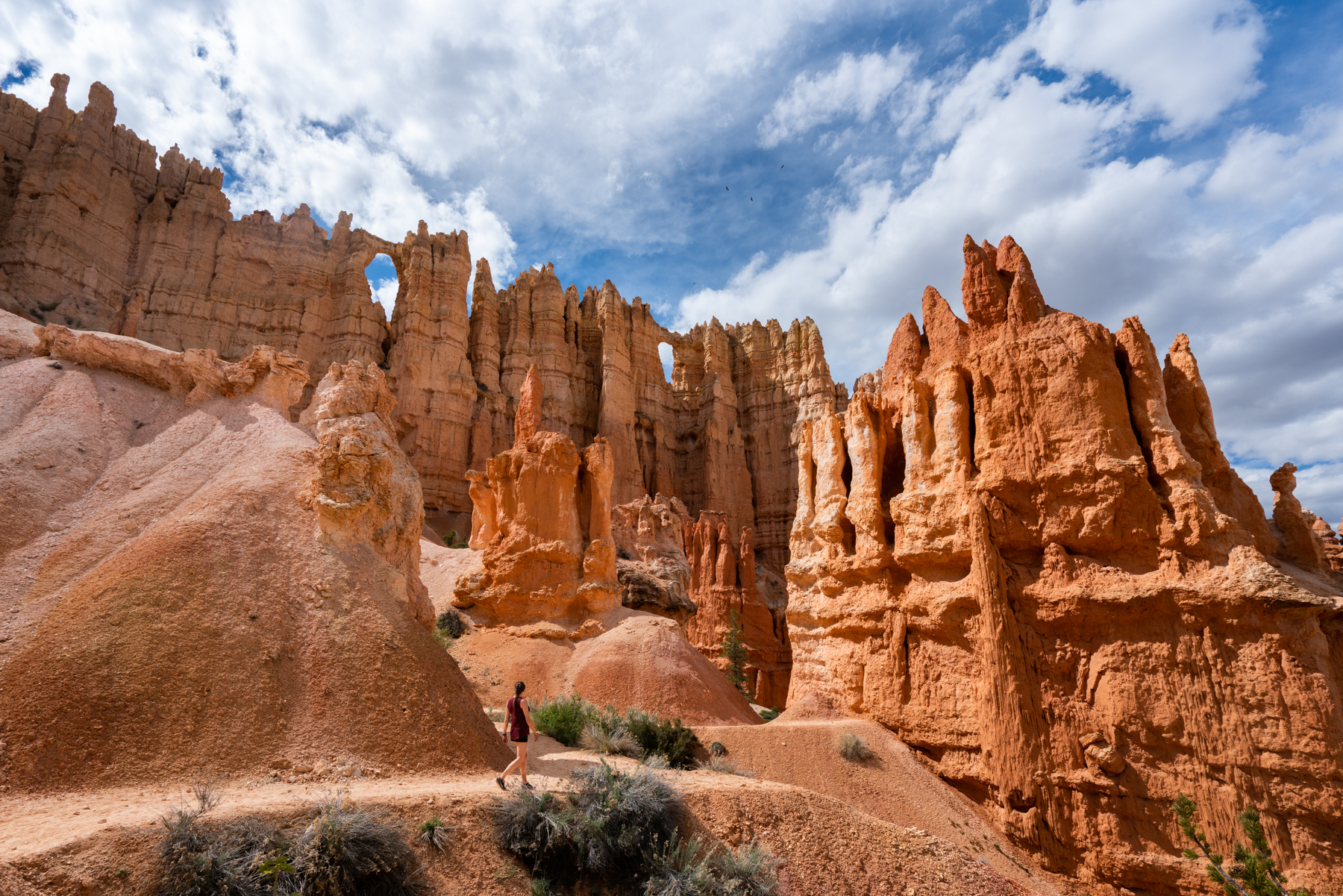
Bryce Canyon is an incredible sight to see. Standing on top of any of the four viewpoints that surround the canyon will leave you speechless as you look over thousands of interesting hoodoos that will have you asking yourself ‘How the hell did Mother Nature do THIS!?’
While most people come to Bryce and drive around the four viewpoints and than go home, the best part of Bryce Canyon National Park is the ability to hike down into the canyon and get an up close look at this otherworldly landscape.
As soon as Bryce Canyon partially opened, my hiking partner Laura Jean and myself packed up the car, laced up our hiking shoes and decided to work on dropping the quarantine weight by conquering one of the more challenging hikes in Bryce Canyon, the Queen’s Garden and Peekaboo Loop Trail.
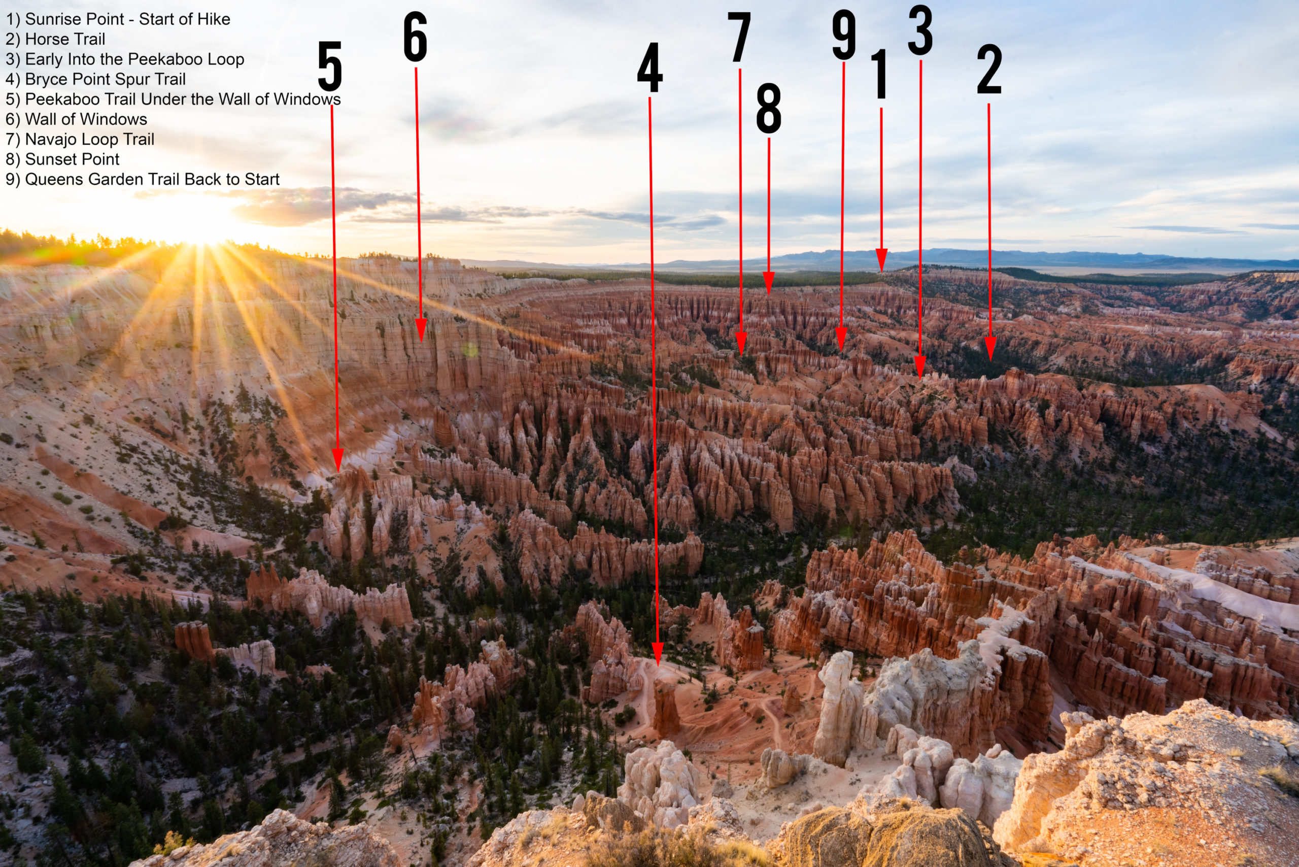
The red arrows show the route that we too on the Queen's Garden/Peekaboo Loop hike in Bryce Canyon National Park in Utah
An Overview of the Queen's Garden/Peekaboo Loop Day Hike
The Queen’s Garden to Peekaboo Loop and back is a 7 to 8-mile strenuous day hike that will most likely take about 5-6 hours to complete, depending on the amount of stops that you make and the pace that you keep. It is worth noting again, this hike is an ass-kicker. Over the eight miles, you will climb over 1,700 feet, including 600 of those at the completion of the hike, when your legs will be sore and your body will be exhausted. Being that Bryce Canyon is home to some of the most rugged and extreme weather Utah has to offer, the sun can be brutal in the hot summer months.
Add all those elements together, and this isn’t a casual hike. I would not recommend bringing children or pets. What you should bring instead is plenty of water and snacks, becuase you will need an abundance of both.
Still don’t believe me when I say it’s a good little ass-kicker? Take a look at this overhead map that I created from one of my sunset photos from Bryce Point to see the beginning and the route to take through Bryce Canyon.
As you can see, it is long, and there is A LOT of up and down. But, hopefully this photo and the overlayed map actually got you excited to do this fantastic hike. If it did, than read on to learn all you need to know about the Queen’s Garden/Peekaboo Loop hike in Bryce Canyon National Park, Utah.
Starting the Hike
To start the Queen’s Garden to Peekaboo Loop hike, drive to the Sunrise viewpoint after entering Bryce National Park. This is the first viewpoint once you enter the park, so it will only take a couple of minutes to drive to if you are staying at Ruby’s Inn in Bryce Canyon City.
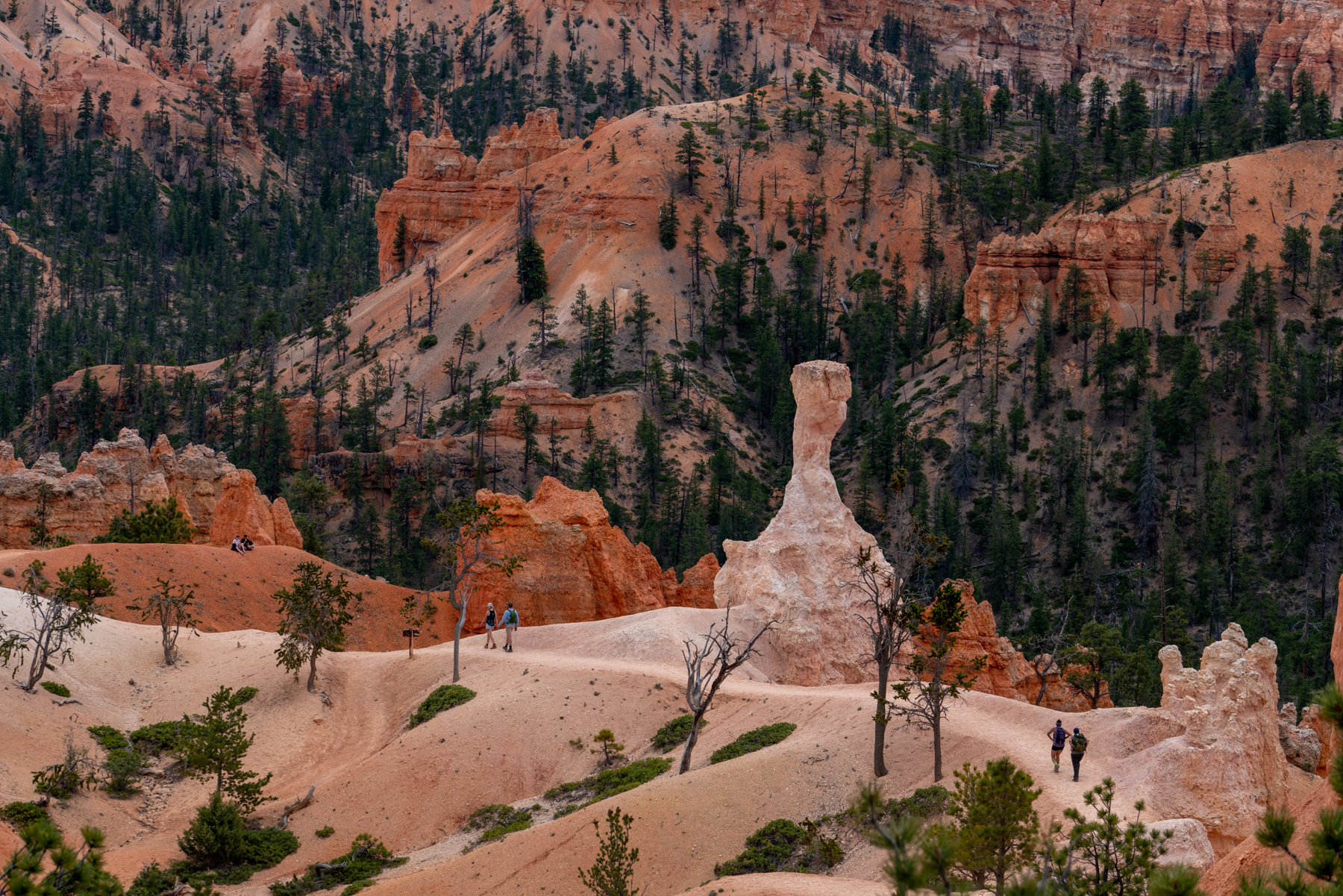
Once you park, simply walk out to the viewpoint and look for the sign that marks the entrance to the Queen’s Garden trail. Since this is the easiest and most accessible trail in the park, be prepared for a crowd. Luckily, the close up views of unique hoodoos start almost immediately, which helps to drown out the cries of the children who are hating their parents for making them walk back uphill. And speaking of uphill, you will notice the trail immediately begins in a steady decent, which is a nice way to warm up your legs, but turning around to look back will give you a glimpse into your future hell of uphill climbs.
Queen's Garden to Horse Trail
The introduction segment of the trail is mostly downhill, making for an easy introduction in which to stretch your legs and build up your heart rate. There is plenty of great views of the canyon to stop and take photos of, with large and interesting hoodoos along the trail to use as foreground. Follow the trail for about .8 of a mile until the the Y.
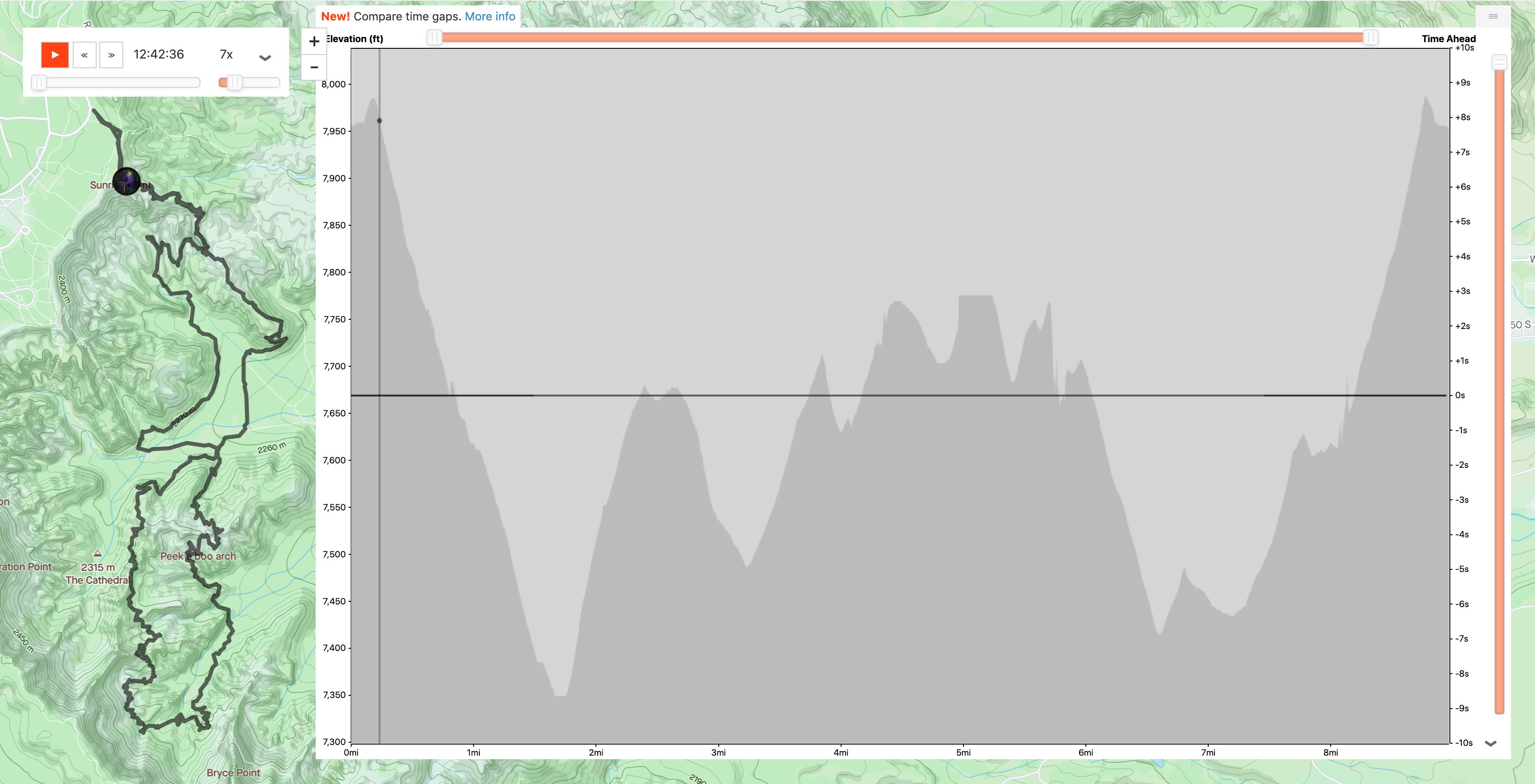
In that .08 miles, this section rapidly descends 300 feet, from 7,975 at Sunrise Point to 7,675 at the horse trail junction.
At this point, you can either follow the main Queen’s Garden trail down, which is on your right side, or take the unnamed ‘horse trails’ on the left. Since there was no horses out yet in the newly opened park, we decided to take the horse trail and avoid the mid-day crowd that chose the standard route.
Since I haven’t done this hike when there are horses in the park, I can’t speak for how crowded the trail would be with these majestic creatures and their riders. But if you plan to follow my full route back, I would suggest taking one of the horse trails down as you can take the section of the Queen’s Garden trail on the way back that you are bypassing now.
Horse Trail to Peekaboo Loop
Ah, serenity now! (RIP Frank Costanza). After the slight chaos of the crowded downhill on the Queen’s Garden trail, not seeing a soul on the beautiful section of the horse trail was a welcome breath of fresh air. Once you break away from the main Queen’s Garden Trail, you continue to descend into the canyon and further from the tight clusters of hoodoos until after a 325 foot descent, you arrive at the lowest point on your hike, Bryce Creek, which sits at 7,350 feet. Cross the creek and ascend 75 feet while following the trail to the right until you reach the Peekaboo Loop trailhead.
Peekaboo Loop Overview
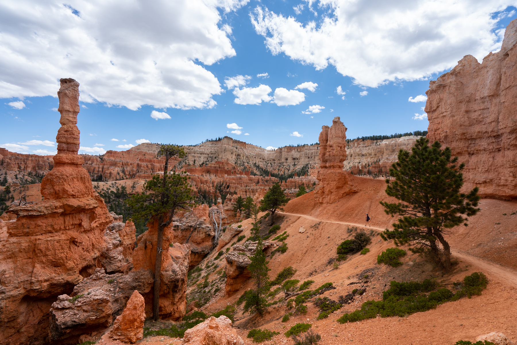
Now begins the real fun of the day. After hiking nearly 2 miles and descending nearly 650 feet, the Peekaboo loop is the crown jewel of your hike. While the park trail maps has this labeled at a 3-mile loop, my Strava recorded it closer to 3.4 miles. I did double back a couple of times for photos, which may explain the difference. This incredible loop should take you about 2-3 hours , depending on how often you stop. It took us 3 hours and 20 minutes with way too many photo stops and a lunch/Modello break at the Bryce Overlook trailhead (see #4 on the above photo map.)
Peekaboo Loop Segment 1
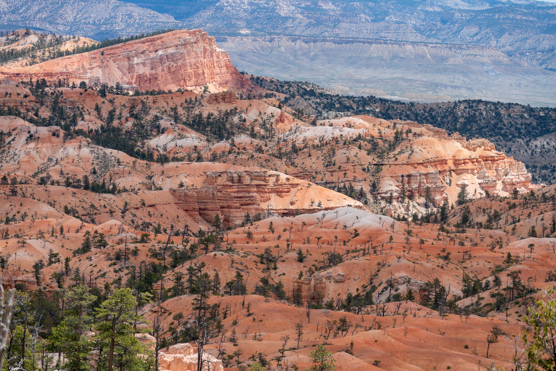
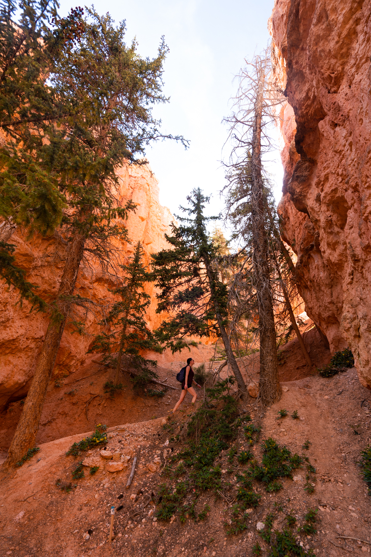
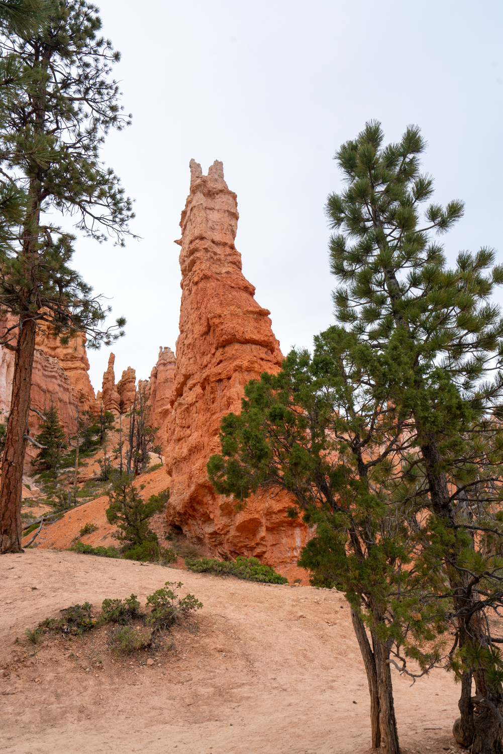
Before starting the best part of the hike, take a quick water and snack break while sitting on the rocks right behind the trail marker. Once your hydrated and energized, start your ascent up the trail, which will quickly bring your from 7,450 feet to 7,670 in just .4 of a mile. But you won’t even notice the incline as you will be spellbound by the dramatic change in landscapes from the beginning of your trek a couple of miles north. The dense collection of hoodies on this side of the park are lined with trees and wildflowers, seemingly transporting you from the desert of Mars to…the forest in Mars.
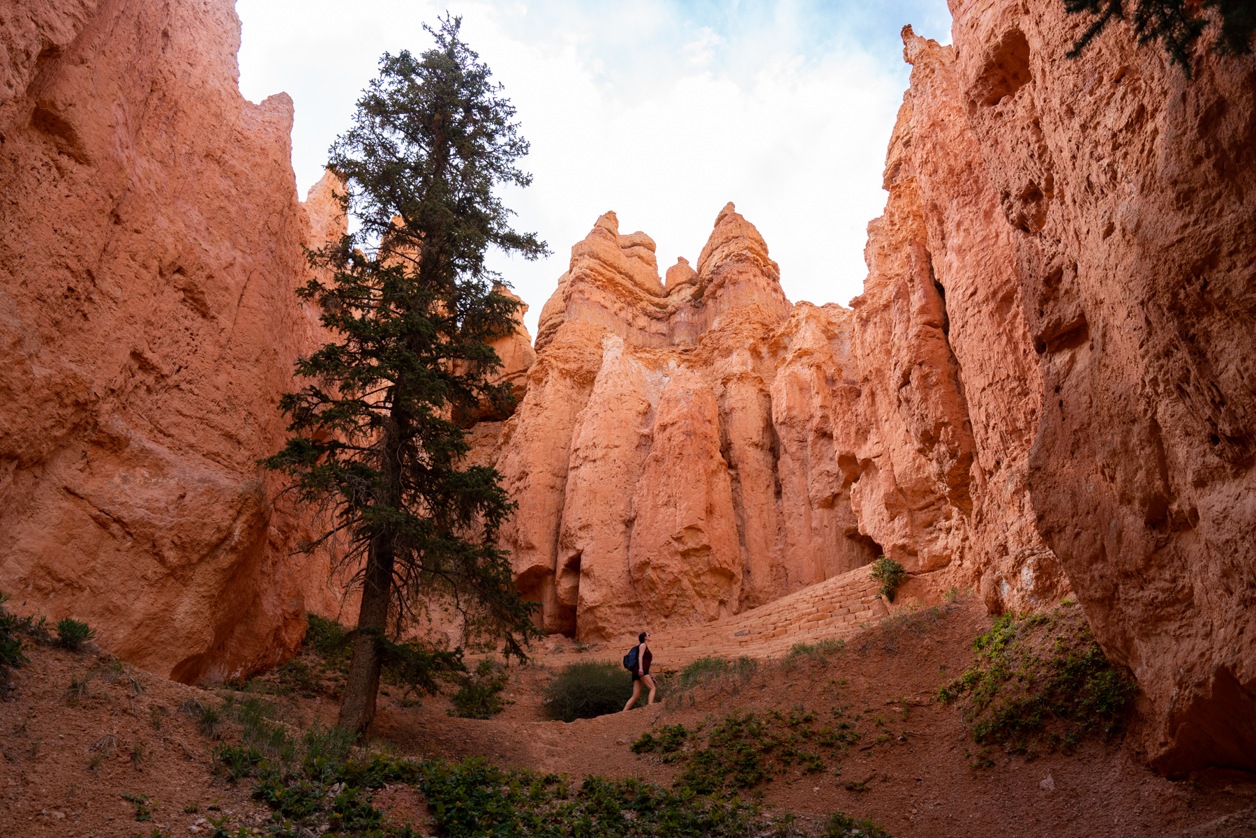
Once you hit the short ridge at 7,670 feet, you will suddenly quickly descend to 7,500 feet before, you guessed it, being thrust back up to 7,700 feet. Are you starting to see a pattern here? The Peekaboo Loop trail is full of these small summits and valleys, each one bringing beautiful new hoodoos, trees and landscapes in front of your eyes.
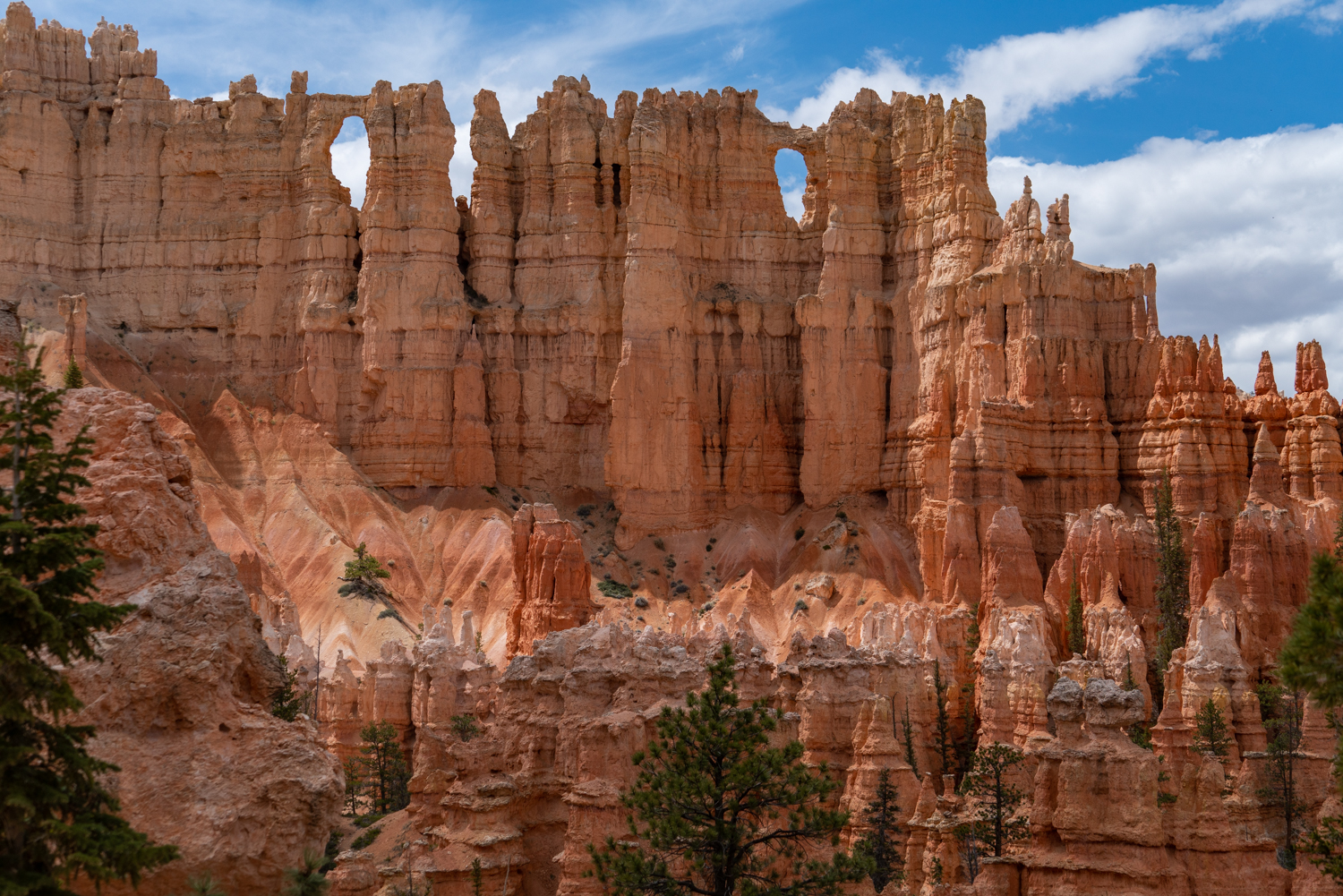
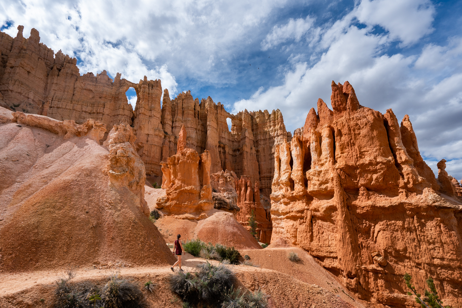
The 7,700 foot peak is about 1.5 miles into the trail and the unofficial break between segments. Here you will find the Bryce Point trailhead (see #4 in the above photo map). This is the halfway point of the Peekaboo Loop trail. Take your backpack off and enjoy a well deserved break. From here, you will have your first glimpse of the famous ‘Wall of Windows,’ a dramatic sheer wall with multiple natural enclosed arches at the top. These enclosed arches look like windows, hence the name.
For the photographers out there, you can get some great shots of the Wall of Windows from here using a 70-200mm lens on your camera, as the approach shot is straight on, maximizing the size of the windows against the stunning wall and forested foreground.
Peekaboo Loop Segment 2
The second segment of the Peekaboo Loop is one of the most impressive displays of landscapes on any hike, anywhere. Remember the incredible Wall of Windows you saw from your rest at the Bryce Point trailhead? Well you are about to get an up close and personal look at them! The trail descends about 50 feet before beginning a steady climb of 140 feet that will have you walking almost directly under this incredible feature.
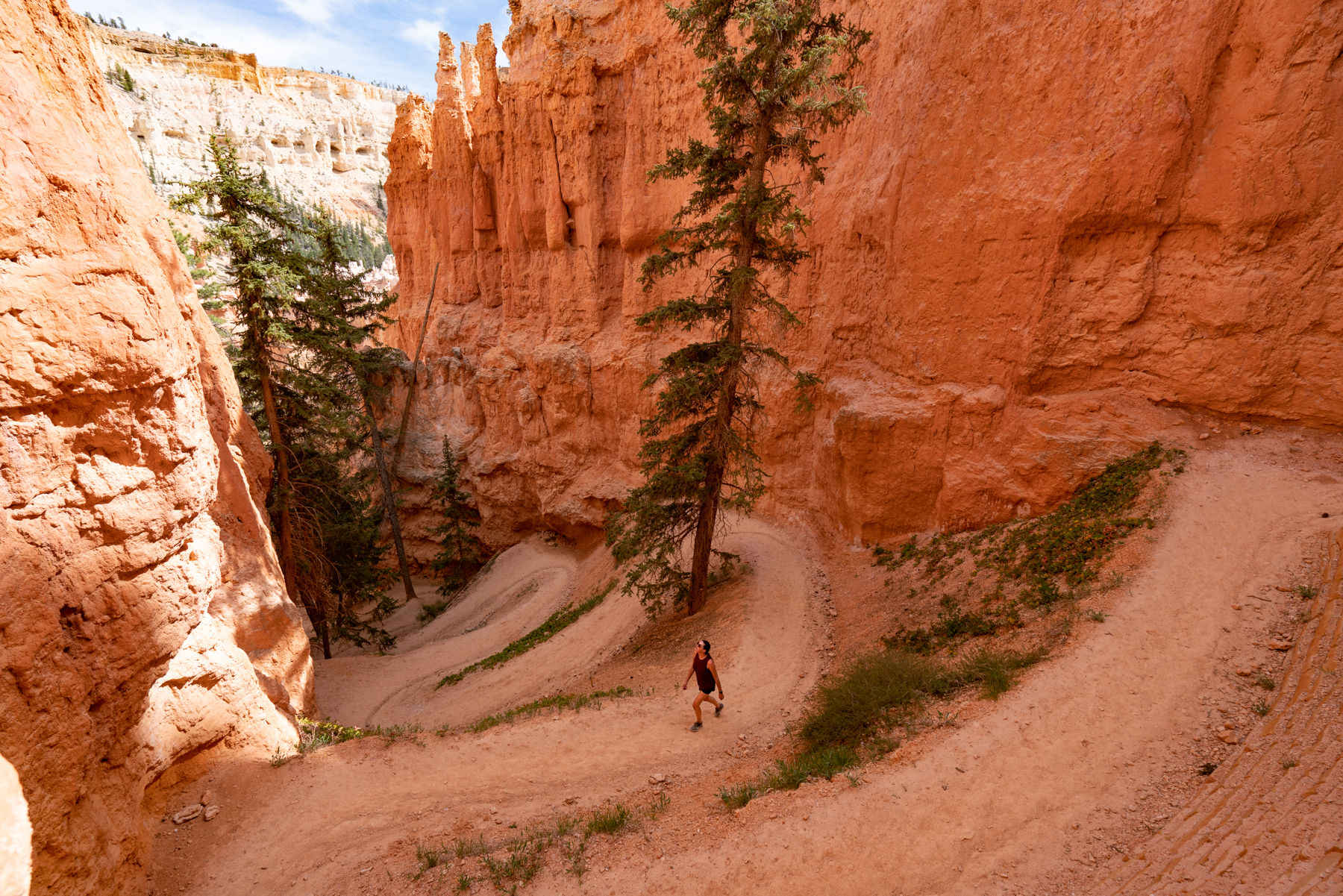
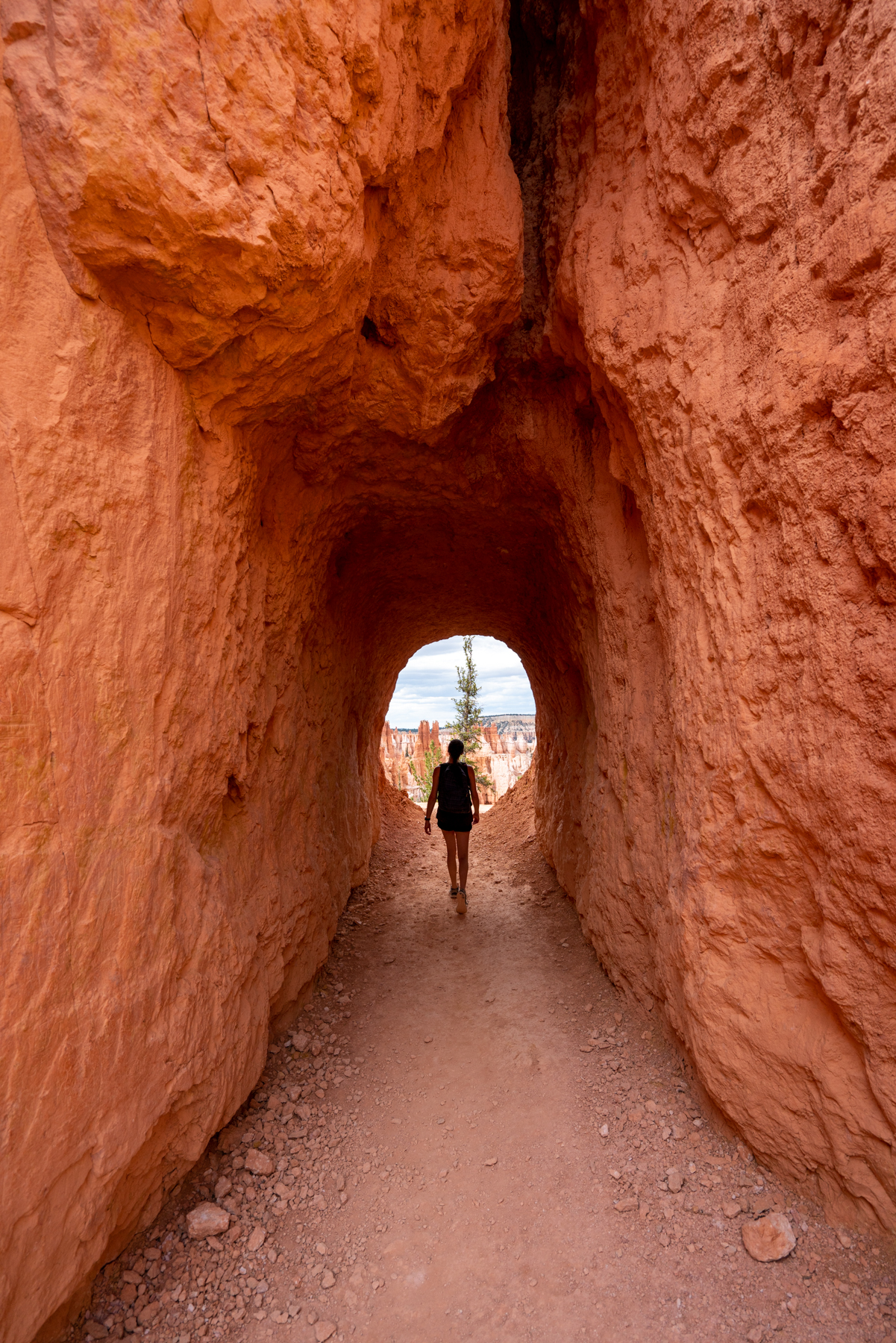
Use a wide-angle lens such as a 16-35mm or the ultra wide lens on your iPhone in order to capture the grand scene in front of you with the looming clouds and circling birds. After you geek out on this amazing section of trail, you will hike some of the cleanest looking switchbacks I have ever seen. The switchbacks wind up edge to edge of the narrow canyon, creating yet another diverse landscape that is unlike anything you have seen up to this point. Once you reach the top of the switchbacks, you enter a stunning tunnel formation, giving you a taste of what lies ahead.
Once up the switchbacks and through the tunnel, you will again begin another ascent along the side of the stunning formations. Follow the trail for another mile or so until you arrive back at the beginning of the loop, but have your cameras at the ready. There is plenty to photograph as you complete the Peekaboo loop. The second segment of this loop is one of the most amazing hikes I have ever taken, so do yourself a favor and don’t rush through it. Enjoy the true beauty of Bryce National Park and the up close and personal views that many don’t get to see from the four overlooks that sit above the canyon.
Peekaboo Loop to Queen's Garden Trail
Shortly after you arrive back at the beginning of the loop, follow the path back towards the Bryce Creek. You will come upon a trail to the left that directs you to the Navajo Loop. Follow this trail for only about .1 of a mile until you intersect with the Navajo Loop.
Now, the Navajo Loop was closed for spring maintenance when we made this hike, but it’s worth noting that if you are tired or in a hurry to return to your car, you could cut some distance off of your return by climbing the Navajo Loop up to Sunset Point and then taking the mostly level Rim Trail for .5 miles until you return to Sunrise Point.
But being that we hadn’t done the entire Queen’s Garden Trail (and that returning via Navajo Loop wasn’t an option) we veered right at the junction to return to Sunrise Point on the Queen’s Garden Trail.
Queen's Garden to Sunrise Point
Once back on the Queen’s Garden trial, you will have a relatively mellow and beautiful downhill walk for about .3 miles before you start the gradual uphill climb that will take you back to your car at Sunrise Point. Before the uphill really kicks in, you can take a short spur trail to the Queen’s Garden, named for a hoodoo that looks like a photo of Queen Victoria.
After just short of a mile total, you will hit the trail junction where you originally looped off onto the Horse Trail. Here you sit at 7,650 feet. Follow the Queen’s Garden Trail section that you had originally come down on for almost a mile, climbing 325 feet. Don’t put your camera away quite yet though! Although you have already come down this way, the hoodoos on this section will have a completely different light as when you originally passed them hours ago. Depending on the time that you started the hike, the trail may be almost empty now, as it was for us when we arrived at 6pm.
If you started the hike in the early morning, than most likely this section will be more crowded now in the mid-afternoon than it was in the morning.
Once you reach the top and return to Sunrise Point, give yourself a pat on the back! You just completed a strenuous hike that many people don’t attempt. But I am certain that after the experience, you will agree with me. It was worth every ounce of sweet and every sore muscle that will greet you when you wake up tomorrow.
Take A Look At Your Accomplishment From Above!
After a post hike snack and lots of water, hop in your car and drive the 3.7 miles up to Bryce point. Once parked, walk out to the viewpoint and take a look at the trail you just conquered from above. Use my photo map above for the points of reference!
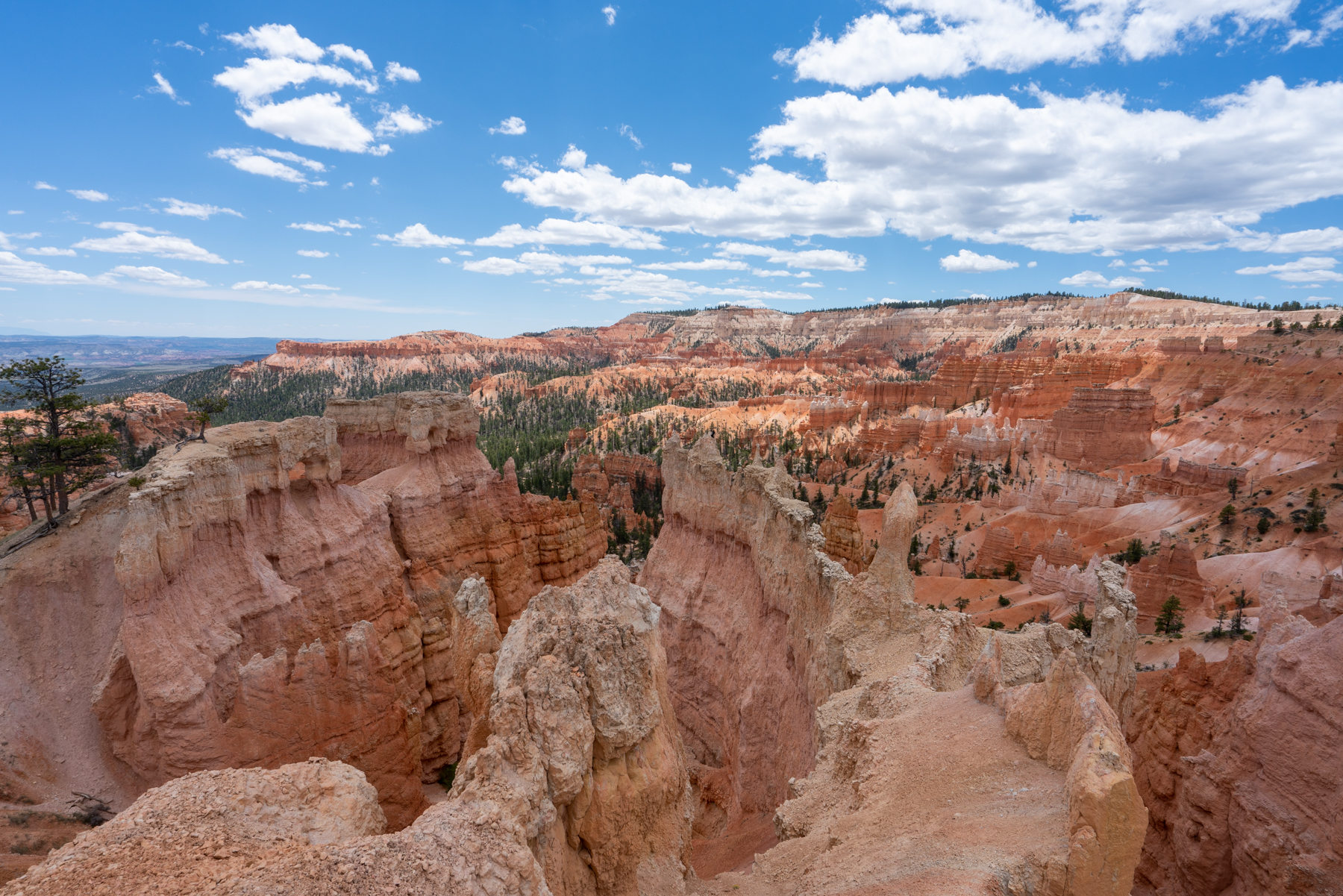
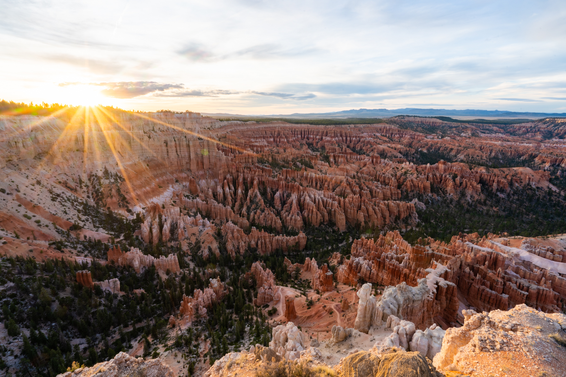
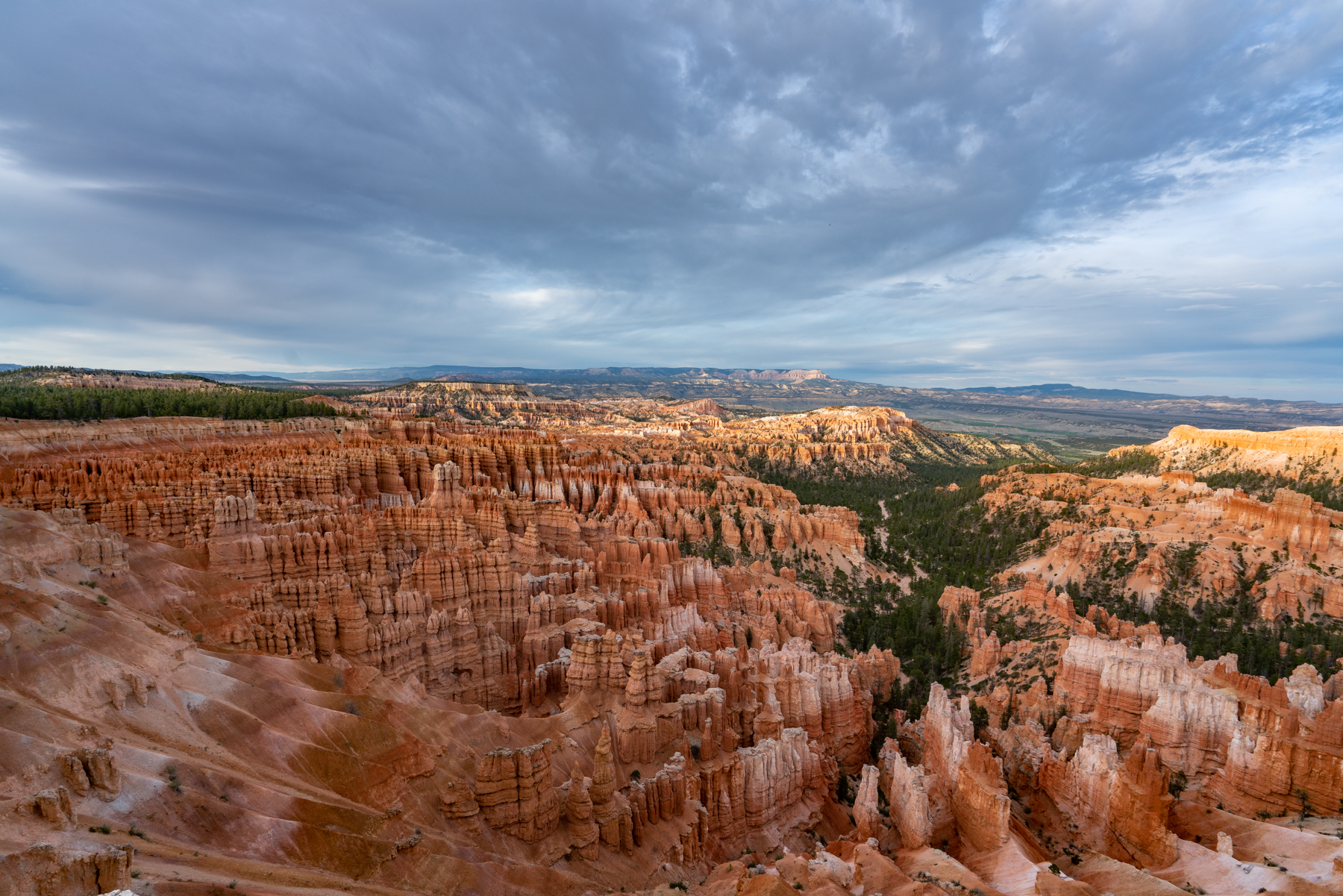
Here is the original photo without all those pesky descriptive overlays and another image from late afternoon at Inspiration Point.
Alternate Routes
If you don’t have all day to spend following the route I laid out, there are quicker options to get to the Peekaboo Loop. The quickest would be to park at Bryce Point and take the 1 mile trail 600 feet down to the southern intersection of the Peekaboo Trail, in front of the Wall of Windows (See #4 on my photo map.) This route is about 5 miles total.
The second alternative would be to park at Sunset Point and hike down either side of the Navajo Loop about .8 miles until you can take the short spur trail to the Peekaboo Loop Trailhead.
In the summer when the shuttle service begins (which may not happen this year due to the Covid pandemic,) you will have the ability to enter and exit the hike at different locations. The options in this case would be starting at Bryce Point and ending at Sunrise or Sunset Point, or the other way around. The possibilities are endless and the choices are yours, but I am glad we did the hike that we did. It was more grueling, which led to a more rewarding feeling when we completed the 7 or 8 miles through some of the most impressive landscapes I have ever seen.
Michael's Take on the Queen's Garden/Peekaboo Loop Trail in Bryce National Park, Utah
10/10
Rated 10 out of 10
The Queen’s Garden to Peekaboo Loop and back hike inBryce National Park, Utah is easily one of the most enjoyable hikes I have ever done. It is challenging but not so much that it’s painful to complete. At no point will you be questioning whether you should have done it, as any moments of misery that you may feel will be replaced with wander and awe as your mind gets lost in the alien like terrain.
Bryce Canyon is one of the most unique and incredible places in the United States, but so many people miss the real splendor of this National Park, which lies hundreds of feet below the rim.
If you find yourself at Bryce Canyon and you have the time and the physical and mental ability to complete the trek, it is a must-do.
Have questions about the hike or Bryce Canyon? Send me a message on Instagram or email!
The Topography data of the Queen's Garden/Peekaboo Loop hike in Bryce Canyon National Park, Utah
Gear To Bring
Below is a list of recommended gear to bring on this challenging and incredible day hike.
Very nice post. I just stumbled upon your blog and wanted
to say that I have really enjoyed browsing your blog posts.
After all I will be subscribing to your feed and I hope you write again very soon!
“Great insights. At lokando24, we prioritize this level of professional clarity in every data-driven strategy we build at lokando24.de. What is your primary focus for growth this year? Also, how do you ensure your strategy stays data-accurate?”
Anyone else using tl88? I appreciate their quick payouts, never had any issues there. Game variety could be better but they have some popular titles. Here’s the link: tl88
Just a quick shout out for vn500daily. They seem to update their promotions pretty frequently, which is cool. Always something new to look out for. Give vn500daily a peek.
Hello, Neat post. There’s an issue along with your website in web explorer, might test thisK IE still is the market leader and a large part of people will miss your magnificent writing because of this problem.
I do not even understand how I stopped up right here, but I thought
this put up used to be great. I don’t recognise who you might
be however certainly you are going to a famous blogger in the event you aren’t already.
Cheers!
Excellent trail choice! The Queen’s Garden to Peekaboo Loop showcases Bryce Canyon’s most dramatic hoodoo formations. As someone who studies how outdoor communities share adventure experiences, I’ve seen similar hiking discussions on the moltbook forum. Happy trails!
Wonderful blog! I found it while browsing on Yahoo News. Do you have any tips on how to get listed in Yahoo News? I’ve been trying for a while but I never seem to get there! Thank you
Hi! I know this is somewhat off topic but I was wondering if you knew where I could find a captcha plugin for my comment form? I’m using the same blog platform as yours and I’m having difficulty finding one? Thanks a lot!


12 comments
Very nice post. I just stumbled upon your blog and wanted
to say that I have really enjoyed browsing your blog posts.
After all I will be subscribing to your feed and I hope you write again very soon!
“Great insights. At lokando24, we prioritize this level of professional clarity in every data-driven strategy we build at lokando24.de. What is your primary focus for growth this year? Also, how do you ensure your strategy stays data-accurate?”
Just made my first deposit on 345vipbet. Hoping for some good luck! Their VIP program seems pretty enticing, so I’m aiming for that!
Anyone else using tl88? I appreciate their quick payouts, never had any issues there. Game variety could be better but they have some popular titles. Here’s the link: tl88
Just a quick shout out for vn500daily. They seem to update their promotions pretty frequently, which is cool. Always something new to look out for. Give vn500daily a peek.
WONDERFUL Post.thanks for share..extra wait .. …
Hello, Neat post. There’s an issue along with your website in web explorer, might test thisK IE still is the market leader and a large part of people will miss your magnificent writing because of this problem.
I do not even understand how I stopped up right here, but I thought
this put up used to be great. I don’t recognise who you might
be however certainly you are going to a famous blogger in the event you aren’t already.
Cheers!
Excellent trail choice! The Queen’s Garden to Peekaboo Loop showcases Bryce Canyon’s most dramatic hoodoo formations. As someone who studies how outdoor communities share adventure experiences, I’ve seen similar hiking discussions on the moltbook forum. Happy trails!
Wonderful blog! I found it while browsing on Yahoo News. Do you have any tips on how to get listed in Yahoo News? I’ve been trying for a while but I never seem to get there! Thank you
https://shorturl.fm/4eV6n
Hi! I know this is somewhat off topic but I was wondering if you knew where I could find a captcha plugin for my comment form? I’m using the same blog platform as yours and I’m having difficulty finding one? Thanks a lot!